
River House Mountain Getaway
Sightseeing
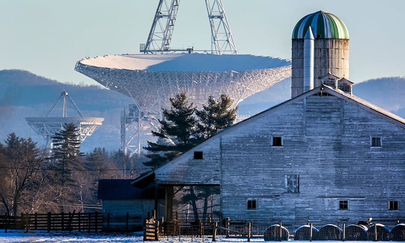
The Greenbank Observatory is one of the world's premier astronomical observatories. This radio telescopes tune in to the whispers of the universe, day and night.
Here in Pocahontas County, we boast some out of this world adventure – literally! Play astronomer for the day.
Discover how radio astronomers learn about the universe by stopping in Green Bank Observatory’s Science Center, going behind the scenes with a High Tech Tour or getting up close and personal with the Green Bank Telescope (the world’s largest steerable telescope).
With daily tours, Green Bank Observatory gives you the chance to discover the world of radio astronomy. Exploring the universe is no easy feat, so you’ll want to fuel up – check out the Starlight Cafe, where you can enjoy wraps, sandwiches, hand-dipped ice cream and more.
While you’re there, stop in the Galaxy Gift Shop to snag some “stellar” gifts, apparel and WV artisan souvenirs.
Green Bank Observatory is located in the National Radio Quiet Zone, a 13,000 square mile region if minimized radio signal interference designated by the US Government in 1958 to create a safe haven for radio astronomy.
Observatory Mission:
We are here to discover black holes, stellar birth, pulsars, Hubble constant, big bang energy, universe expansion, and the origins of life. To See the Unseen. We are here to harness the power of radio waves to explore astronomy. To Foster Innovation and Curiosity. We are here to escape from the noise and learn, share, teach. We are on the pursuit of knowledge… and talk about Einstein’s General Theory of Relativity, too. To Educate. We are here to encourage your sense of wonder for the unknown beyond our planet.
25 (рекомендации местных жителей)
Green Bank Observatory
155 Observatory RdThe Greenbank Observatory is one of the world's premier astronomical observatories. This radio telescopes tune in to the whispers of the universe, day and night.
Here in Pocahontas County, we boast some out of this world adventure – literally! Play astronomer for the day.
Discover how radio astronomers learn about the universe by stopping in Green Bank Observatory’s Science Center, going behind the scenes with a High Tech Tour or getting up close and personal with the Green Bank Telescope (the world’s largest steerable telescope).
With daily tours, Green Bank Observatory gives you the chance to discover the world of radio astronomy. Exploring the universe is no easy feat, so you’ll want to fuel up – check out the Starlight Cafe, where you can enjoy wraps, sandwiches, hand-dipped ice cream and more.
While you’re there, stop in the Galaxy Gift Shop to snag some “stellar” gifts, apparel and WV artisan souvenirs.
Green Bank Observatory is located in the National Radio Quiet Zone, a 13,000 square mile region if minimized radio signal interference designated by the US Government in 1958 to create a safe haven for radio astronomy.
Observatory Mission:
We are here to discover black holes, stellar birth, pulsars, Hubble constant, big bang energy, universe expansion, and the origins of life. To See the Unseen. We are here to harness the power of radio waves to explore astronomy. To Foster Innovation and Curiosity. We are here to escape from the noise and learn, share, teach. We are on the pursuit of knowledge… and talk about Einstein’s General Theory of Relativity, too. To Educate. We are here to encourage your sense of wonder for the unknown beyond our planet.
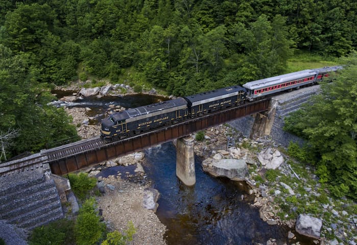
At the Cass Scenic Railroad State Park, you can relive the Golden Age of Steam on a line built in 1901 to haul lumber from the forest to the mill, riding in refurbished logging flat-cars pulled by an original Shay steam locomotive. The full 4.5-hour trip includes switchbacks that allow the train to climb grades as high as 11 percent to reach Bald Knob. At an altitude of 4,700 feet, this is West Virginia's third highest point, overlooking spectacular views.
At Whittaker Station, a 1940s logging camp has been recreated, with the living quarters and the equipment. At the base, you can tour a museum and the depot and see restored company houses that can be rented for overnight stays. On the train ride, be prepared for noise, black smoke, and chilly temperatures at Bald Knob.
66 (рекомендации местных жителей)
Государственный парк живописной железной дороги Касс
12363 Cass RdAt the Cass Scenic Railroad State Park, you can relive the Golden Age of Steam on a line built in 1901 to haul lumber from the forest to the mill, riding in refurbished logging flat-cars pulled by an original Shay steam locomotive. The full 4.5-hour trip includes switchbacks that allow the train to climb grades as high as 11 percent to reach Bald Knob. At an altitude of 4,700 feet, this is West Virginia's third highest point, overlooking spectacular views.
At Whittaker Station, a 1940s logging camp has been recreated, with the living quarters and the equipment. At the base, you can tour a museum and the depot and see restored company houses that can be rented for overnight stays. On the train ride, be prepared for noise, black smoke, and chilly temperatures at Bald Knob.
With elevations ranging from around 1,000 feet to 4,863 feet above sea level, the Monongahela National Forest offers beautiful views, wildlife, and the highest point in the state. The variety of terrain and rainfall across its more than 900,000 acres gives it one of the most diverse forest ecosystems in the country, supporting more than 225 bird species; 75 species of trees; and 70 fish species, both game and non-game.
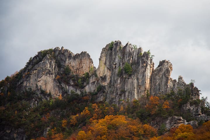
About 100,000 acres of the park are designated as the Spruce Knob-Seneca Rocks National Recreation Area, offering some of the best traditional multi-pitch technical climbing on the east coast. Seneca Rocks is a distinctive 250-foot-deep formation of white and gray quartzite that stands almost 900 feet above the North Fork River. Some routes are moderate, but experts are challenged by the exposed summit pinnacle.
14 (рекомендации местных жителей)
Monongahela National Forest
200 Sycamore StWith elevations ranging from around 1,000 feet to 4,863 feet above sea level, the Monongahela National Forest offers beautiful views, wildlife, and the highest point in the state. The variety of terrain and rainfall across its more than 900,000 acres gives it one of the most diverse forest ecosystems in the country, supporting more than 225 bird species; 75 species of trees; and 70 fish species, both game and non-game.
About 100,000 acres of the park are designated as the Spruce Knob-Seneca Rocks National Recreation Area, offering some of the best traditional multi-pitch technical climbing on the east coast. Seneca Rocks is a distinctive 250-foot-deep formation of white and gray quartzite that stands almost 900 feet above the North Fork River. Some routes are moderate, but experts are challenged by the exposed summit pinnacle.
Seneca Rocks is a large crag and major landmark. The south peak is one of a small number of peaks inaccessible except by technical rock climbing techniques on the East Coast of the United States. One of the best-known scenic attractions in West Virginia, the sheer rock faces are a popular challenge for rock climbers.
Seneca Rocks is easily visible from, and accessible by way of, West Virginia Route 28, West Virginia Route 55 and U.S. Route 33 in the Spruce Knob-Seneca Rocks National Recreation Area of the Monongahela National Forest. The three highways converge in the hamlet of Seneca Rocks, which is named for the cliffs nearby. Seneca Rocks is one of the best-known landmarks in West Virginia. These rocks have long been noted as a scenic attraction and are popular with rock climbers.
The rocks are a magnificent formation rising nearly 900 feet above the North Fork River. You don’t need to be a climber to enjoy the park. Non-climbers can visit the Seneca Rocks Discovery Center, go fishing, or hike and spot birds in the park’s thousands of acres of wildlands.
36 (рекомендации местных жителей)
Seneca Rocks
Seneca Rocks is a large crag and major landmark. The south peak is one of a small number of peaks inaccessible except by technical rock climbing techniques on the East Coast of the United States. One of the best-known scenic attractions in West Virginia, the sheer rock faces are a popular challenge for rock climbers.
Seneca Rocks is easily visible from, and accessible by way of, West Virginia Route 28, West Virginia Route 55 and U.S. Route 33 in the Spruce Knob-Seneca Rocks National Recreation Area of the Monongahela National Forest. The three highways converge in the hamlet of Seneca Rocks, which is named for the cliffs nearby. Seneca Rocks is one of the best-known landmarks in West Virginia. These rocks have long been noted as a scenic attraction and are popular with rock climbers.
The rocks are a magnificent formation rising nearly 900 feet above the North Fork River. You don’t need to be a climber to enjoy the park. Non-climbers can visit the Seneca Rocks Discovery Center, go fishing, or hike and spot birds in the park’s thousands of acres of wildlands.
The Scenic Area is in the headwaters of Glade Run and Old Road Run, tributaries of Shavers Fork of Cheat River and West Fork of Greenbrier River, respectively. The 140 acre Gaudineer Scenic Area is located near Gaudineer Knob of Shavers Mountain in Randolph and Pocahontas Counties. The area is located about 5.5 miles from Durbin, West Virginia. This is an old growth forest area and is what our country looked like before civilization came along.
Gaudineer Scenic Area
The Scenic Area is in the headwaters of Glade Run and Old Road Run, tributaries of Shavers Fork of Cheat River and West Fork of Greenbrier River, respectively. The 140 acre Gaudineer Scenic Area is located near Gaudineer Knob of Shavers Mountain in Randolph and Pocahontas Counties. The area is located about 5.5 miles from Durbin, West Virginia. This is an old growth forest area and is what our country looked like before civilization came along.
Snowshoe Mountain Resort is the premier destination for Mid-Atlantic & Southeast skiers, snowboarders and winter enthusiasts. But the fun doesn't stop after winter. Enjoy our world class events, cool mountain temperatures, beautiful vistas and 11,000 acres of unspoiled wilderness year round. From adventure to relaxation, we have everything you need for a perfect getaway. Voted #1 Ski Resort in the Southeast since 1996. Summer brings golf, hiking and horseback riding.
48 (рекомендации местных жителей)
Snowshoe
Snowshoe Mountain Resort is the premier destination for Mid-Atlantic & Southeast skiers, snowboarders and winter enthusiasts. But the fun doesn't stop after winter. Enjoy our world class events, cool mountain temperatures, beautiful vistas and 11,000 acres of unspoiled wilderness year round. From adventure to relaxation, we have everything you need for a perfect getaway. Voted #1 Ski Resort in the Southeast since 1996. Summer brings golf, hiking and horseback riding.
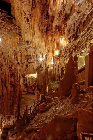
Seneca Caverns Company offers the Seneca Caverns Tour. It has been open to visitors since 1928. The caverns feature unique geological formations that are visually stunning and wondrous. Guides lead visitors through the tours, pointing out areas of special interest, providing information and answering questions.
Tours of Seneca Caverns last approximately one hour, during which time visitors are led along a well lit pathway. The path through the cavern dips to 165 feet below the entrance; cement steps are provided as well as handrails. Over the years, hundreds of thousands of visitors of all ages have made the trip. Many a visitor reminisces about coming to Seneca Caverns as a child and then delights in bringing their own children for the journey.
17 (рекомендации местных жителей)
Seneca Caverns
3328 Germany Valley RdSeneca Caverns Company offers the Seneca Caverns Tour. It has been open to visitors since 1928. The caverns feature unique geological formations that are visually stunning and wondrous. Guides lead visitors through the tours, pointing out areas of special interest, providing information and answering questions.
Tours of Seneca Caverns last approximately one hour, during which time visitors are led along a well lit pathway. The path through the cavern dips to 165 feet below the entrance; cement steps are provided as well as handrails. Over the years, hundreds of thousands of visitors of all ages have made the trip. Many a visitor reminisces about coming to Seneca Caverns as a child and then delights in bringing their own children for the journey.
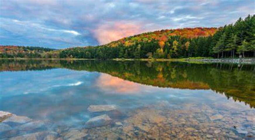
Lake Buffalo is a 22-acre lake that offers fishermen a quiet retreat. It is regularly stocked with trout by the West Virginia Division of Natural Resources. Lake Buffalo is located near the town of Bartow. Facilities include a parking lot, a picnic area, and a concrete boat ramp.
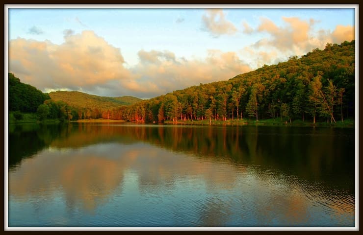
Lake Buffalo
Lake Buffalo is a 22-acre lake that offers fishermen a quiet retreat. It is regularly stocked with trout by the West Virginia Division of Natural Resources. Lake Buffalo is located near the town of Bartow. Facilities include a parking lot, a picnic area, and a concrete boat ramp.
Seneca Lake is a reservoir located just 10 miles from Marlinton, in Pocahontas County, in the state of West Virginia, United States, near Clover Lick, WV. Fishermen will find a variety of fish including lake trout, rainbow trout, brown trout, smallmouth bass, northern pike, largemouth bass, bullhead and perch here. Whether you’re baitcasting, spinning, trolling or fly fishing your chances of getting a bite here are good. So grab your favorite fly fishing rod and reel, and head out to Seneca Lake.
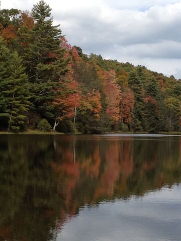
Seneca Lake
Seneca Lake is a reservoir located just 10 miles from Marlinton, in Pocahontas County, in the state of West Virginia, United States, near Clover Lick, WV. Fishermen will find a variety of fish including lake trout, rainbow trout, brown trout, smallmouth bass, northern pike, largemouth bass, bullhead and perch here. Whether you’re baitcasting, spinning, trolling or fly fishing your chances of getting a bite here are good. So grab your favorite fly fishing rod and reel, and head out to Seneca Lake.
Smoke Hole Caverns
The history of Smoke Hole Caverns is tied to the Seneca Indians who used the front section of the caverns to smoke wild game. The slow-burning wood fires sent clouds of smoke swirling out into the valley. The scene was so common that early settlers called the place Smoke Hole.
The many rooms and secluded nature of the Caverns were also the ideal place for early settlers and immigrants to make corn whiskey after the Civil War. The clean cold stream that flows through the Caverns was perfect for “moonshine” and it is estimated that perhaps as many as 20 stills operated at one time!! An original still remains on display today complete with its story.
Deep under the now scenic beauty of West Virginia, the Smoke Hole Caverns provide visitors with a peek into the scenery below the surface. Caverns and the breathtaking beauty that fills them are created by the constant, trickling flow of mineral-carrying water that deposits the minerals making stalactites and stalagmites. Stalactites are mineral formations that hang from the ceiling of a cavern, a stalagmite is a mineral formation formed on the floor. Each of these is generally cone-shaped.
For those who have never been into a cavern, Smoke Hole Caverns is a must visit. The bizarre-looking formations of minerals look like a scene from a lost world of an old science fiction movie. Bring a jacket as the caverns are a pleasant 56 degrees year round.
Smoke Hole
Smoke Hole Caverns
The history of Smoke Hole Caverns is tied to the Seneca Indians who used the front section of the caverns to smoke wild game. The slow-burning wood fires sent clouds of smoke swirling out into the valley. The scene was so common that early settlers called the place Smoke Hole.
The many rooms and secluded nature of the Caverns were also the ideal place for early settlers and immigrants to make corn whiskey after the Civil War. The clean cold stream that flows through the Caverns was perfect for “moonshine” and it is estimated that perhaps as many as 20 stills operated at one time!! An original still remains on display today complete with its story.
Deep under the now scenic beauty of West Virginia, the Smoke Hole Caverns provide visitors with a peek into the scenery below the surface. Caverns and the breathtaking beauty that fills them are created by the constant, trickling flow of mineral-carrying water that deposits the minerals making stalactites and stalagmites. Stalactites are mineral formations that hang from the ceiling of a cavern, a stalagmite is a mineral formation formed on the floor. Each of these is generally cone-shaped.
For those who have never been into a cavern, Smoke Hole Caverns is a must visit. The bizarre-looking formations of minerals look like a scene from a lost world of an old science fiction movie. Bring a jacket as the caverns are a pleasant 56 degrees year round.
Beartown State Park
The name "Beartown State Park" was chosen because local residents claimed that many cave-like openings in the rocks made ideal winter dens for the native black bears, the state animal of West Virginia. Also because the many deep, narrow crevasses were formed in a regular criss-cross pattern which appear from above like the streets of a small town. Beartown is noted for its unusual rock formations, which consist of Droop, or Pottsville, Sandstone formed during the Pennsylvanian age. Massive boulders, overhanging cliffs and deep crevasses make up the beauty of the park.
33 (рекомендации местных жителей)
Beartown State Park
Beartown RoadBeartown State Park
The name "Beartown State Park" was chosen because local residents claimed that many cave-like openings in the rocks made ideal winter dens for the native black bears, the state animal of West Virginia. Also because the many deep, narrow crevasses were formed in a regular criss-cross pattern which appear from above like the streets of a small town. Beartown is noted for its unusual rock formations, which consist of Droop, or Pottsville, Sandstone formed during the Pennsylvanian age. Massive boulders, overhanging cliffs and deep crevasses make up the beauty of the park.
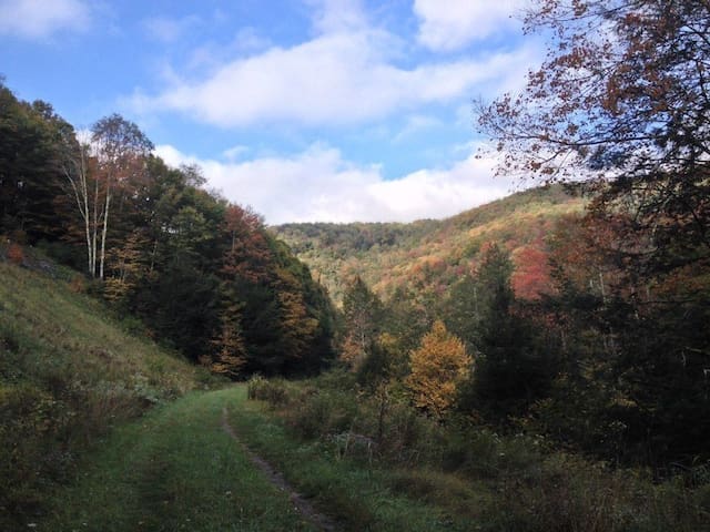
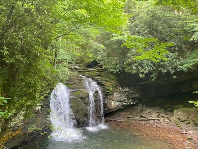
The scenic East Fork Trail follows the East Fork of the Greenbrier River through hemlock stands and pine plantations and past many small waterfalls, extending 8 miles from the Island Campground in Bartow to Pig’s Ear Road (Forest Service Road 254). The trail can be difficult going on a mountain bike and is recommended for hiking only.
During the winter thaw and spring rains, this trail gets wet and muddy, with stream crossings at mile 2.5 and near mile 6. You can avoid the first crossing by staying on the east side of the stream and looking for the trail blazes again within 300 yards. The final section of the trail leaves the banks of the Greenbrier River and follows a steep uphill climb to Pig’s Ear Road.
The East Fork Trail is a treat at any time of year, but if you hit the trail during berry season, be sure to look around for tasty, wild service berries, also called mountain blueberries, which can be found along the entire corridor.
Anglers, rafters and others have overnight options along the trail. In addition to the small campground at the trail’s start, there are more campsites near mile 5, where the trail crosses Forest Service Road 51.
East Fork Trail
East Fork TrailThe scenic East Fork Trail follows the East Fork of the Greenbrier River through hemlock stands and pine plantations and past many small waterfalls, extending 8 miles from the Island Campground in Bartow to Pig’s Ear Road (Forest Service Road 254). The trail can be difficult going on a mountain bike and is recommended for hiking only.
During the winter thaw and spring rains, this trail gets wet and muddy, with stream crossings at mile 2.5 and near mile 6. You can avoid the first crossing by staying on the east side of the stream and looking for the trail blazes again within 300 yards. The final section of the trail leaves the banks of the Greenbrier River and follows a steep uphill climb to Pig’s Ear Road.
The East Fork Trail is a treat at any time of year, but if you hit the trail during berry season, be sure to look around for tasty, wild service berries, also called mountain blueberries, which can be found along the entire corridor.
Anglers, rafters and others have overnight options along the trail. In addition to the small campground at the trail’s start, there are more campsites near mile 5, where the trail crosses Forest Service Road 51.
Droop Mountain Battlefield State Park is a state park located on Droop Mountain in Pocahontas County, West Virginia. The park was the site of the Battle of Droop Mountain, the last major battle of the American Civil War in the state taking place on November 6, 1863. John D. Sutton, a West Virginia private in the Union Army at the battle, became the leader in the movement to create the park when he served in the West Virginia House of Delegates. Dedicated on July 4, 1928, Droop Mountain Battlefield became the first state park in West Virginia.
21 (рекомендации местных жителей)
Droop Mountain Battlefield State Park
683 Droop Park RoadDroop Mountain Battlefield State Park is a state park located on Droop Mountain in Pocahontas County, West Virginia. The park was the site of the Battle of Droop Mountain, the last major battle of the American Civil War in the state taking place on November 6, 1863. John D. Sutton, a West Virginia private in the Union Army at the battle, became the leader in the movement to create the park when he served in the West Virginia House of Delegates. Dedicated on July 4, 1928, Droop Mountain Battlefield became the first state park in West Virginia.
At 4,863 feet above sea level, Spruce Knob is West Virginia's highest peak. This area offers backpacking and day hiking opportunities for the visitors looking to get a splendid view of the gorgeous natural scenery surrounding the area. From this rugged alpine peak, you can view grassy openings and pastures or look down on forested ridges as far as the eye can see. The vegetation here has adapted to a harsh environment. One-sided red spruce deformed by constant exposure to strong westerly winds cling to the high rocky ridges. Blueberry and huckleberry plants hug the ground.
Spruce Knob Tower - A stone and steel observation tower sits atop the Knob, providing visitors with a vantage point from which to enjoy a breathtaking view. The half-mile Whispering Spruce Trail circles the knob and provides panoramic views. Interpretive signs along the gentle, graveled trail describe the high country vegetation, geology and animal life.
Vault toilets, picnic tables, grills and vehicle parking complete the facilities available at the tower. Toilets are closed in winter.
Spruce Knob Lake has boating and fishing opportunities. You are welcome to backpack the 60 miles of trail offered in nearby Spruce Knob - Seneca Creek Backcountry.
37 (рекомендации местных жителей)
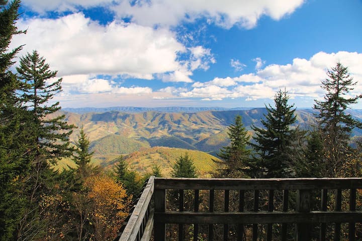
Spruce Knob
At 4,863 feet above sea level, Spruce Knob is West Virginia's highest peak. This area offers backpacking and day hiking opportunities for the visitors looking to get a splendid view of the gorgeous natural scenery surrounding the area. From this rugged alpine peak, you can view grassy openings and pastures or look down on forested ridges as far as the eye can see. The vegetation here has adapted to a harsh environment. One-sided red spruce deformed by constant exposure to strong westerly winds cling to the high rocky ridges. Blueberry and huckleberry plants hug the ground.
Spruce Knob Tower - A stone and steel observation tower sits atop the Knob, providing visitors with a vantage point from which to enjoy a breathtaking view. The half-mile Whispering Spruce Trail circles the knob and provides panoramic views. Interpretive signs along the gentle, graveled trail describe the high country vegetation, geology and animal life.
Vault toilets, picnic tables, grills and vehicle parking complete the facilities available at the tower. Toilets are closed in winter.
Spruce Knob Lake has boating and fishing opportunities. You are welcome to backpack the 60 miles of trail offered in nearby Spruce Knob - Seneca Creek Backcountry.
Built in 1952 for fishing, the 25-acre Spruce Knob Lake is regularly stocked with trout by the West Virginia Division of Natural Resources. It serves as one of the state’s most unique fisheries.
7 (рекомендации местных жителей)
Spruce Knob Lake
Built in 1952 for fishing, the 25-acre Spruce Knob Lake is regularly stocked with trout by the West Virginia Division of Natural Resources. It serves as one of the state’s most unique fisheries.
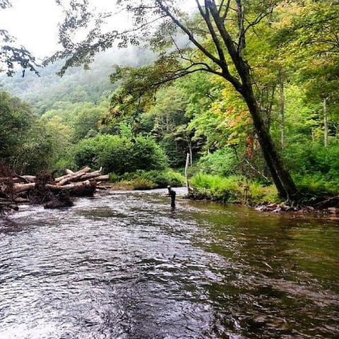
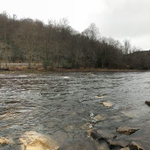
The East Fork of The Greenbrier River runs through Durbin and is a favorite for anglers in search of brook, brown, rainbow and golden trout. The river is stocked with trout regularly by the West Virginia Department of Natural Resources. The river is also known for its' pristine kayak and float trips. The Greenbrier is the longest untamed (unblocked) river left in the Eastern United States. It is heavily used for recreational pursuits. Its upper reaches flow through the Monongahela National Forest, and it is paralleled for 77 miles (124 km) by the Greenbrier River Trail, a rail trail which runs between the communities of Cass and North Caldwell.
It has always been a valuable water route, with the majority of the important cities in the watershed being established riverports. The river gives the receiving waters of the New River an estimated 30% of its water volume. Over three-fourths of the watershed is an extensive karstic (cavern system), which supports fine trout fishing, cave exploration and recreation. Many important festivals and public events are held along the river throughout the watershed.
East Fork Greenbrier River
The East Fork of The Greenbrier River runs through Durbin and is a favorite for anglers in search of brook, brown, rainbow and golden trout. The river is stocked with trout regularly by the West Virginia Department of Natural Resources. The river is also known for its' pristine kayak and float trips. The Greenbrier is the longest untamed (unblocked) river left in the Eastern United States. It is heavily used for recreational pursuits. Its upper reaches flow through the Monongahela National Forest, and it is paralleled for 77 miles (124 km) by the Greenbrier River Trail, a rail trail which runs between the communities of Cass and North Caldwell.
It has always been a valuable water route, with the majority of the important cities in the watershed being established riverports. The river gives the receiving waters of the New River an estimated 30% of its water volume. Over three-fourths of the watershed is an extensive karstic (cavern system), which supports fine trout fishing, cave exploration and recreation. Many important festivals and public events are held along the river throughout the watershed.
There are many trails along Cheat Mountain in the upper Shavers Fork area that are a great place to start your outdoor adventure. Whether it’s fishing, hunting, horseback riding, cross country skiing, snowshoeing, hiking, or mountain biking, Cheat Mountain is one of the largest and most rugged mountain terrains in the Alleghenies. Year-round these activities provide a great way to explore this unique and wonderful part of West Virginia. The Cheat Mountain Loop is ideal for those seeking an easy ride experience in the area.
The variety of trails within the Monongahela National Forest that are available entice the outdoor enthusiast from the leisurely hiker to the outdoor enthusiast. There are many hunting prospects available in the Cheat Mountain WMA during the available season. Some of these prospects include bear, deer, grouse, snowshoe hare, squirrel, turkey, woodcock, bobcat, fox, and raccoon. Stonecoal Dispersed Camping Area is within the Cheat Mountain WMA, providing many primitive campsites as well as access to miles of the Shavers Fork of the Cheat River.
An outdoorsman’s dream, West Virginia is home to arguably the best public lands for hunting and fishing.
Cheat Mountain
There are many trails along Cheat Mountain in the upper Shavers Fork area that are a great place to start your outdoor adventure. Whether it’s fishing, hunting, horseback riding, cross country skiing, snowshoeing, hiking, or mountain biking, Cheat Mountain is one of the largest and most rugged mountain terrains in the Alleghenies. Year-round these activities provide a great way to explore this unique and wonderful part of West Virginia. The Cheat Mountain Loop is ideal for those seeking an easy ride experience in the area.
The variety of trails within the Monongahela National Forest that are available entice the outdoor enthusiast from the leisurely hiker to the outdoor enthusiast. There are many hunting prospects available in the Cheat Mountain WMA during the available season. Some of these prospects include bear, deer, grouse, snowshoe hare, squirrel, turkey, woodcock, bobcat, fox, and raccoon. Stonecoal Dispersed Camping Area is within the Cheat Mountain WMA, providing many primitive campsites as well as access to miles of the Shavers Fork of the Cheat River.
An outdoorsman’s dream, West Virginia is home to arguably the best public lands for hunting and fishing.
Little River Wildlife Management Area is a 121,552 acre National Forest in Pocahontas County. The property is owned by U.S. Forest Service and managed by WV Division of Natural Resources, Wildlife Resources Section and US Forest Service.
The terrain of the area: Northern hardwoods cover the mountainous terrain with oak-hickory and black cherry, white pine and red pine also present.
Hunting, Trapping, and Fishing:
Hunting Opportunities: Deer, Turkey, Bear, Waterfowl, Squirrel, Rabbit, Grouse, Dove, Woodcock, & Snow Hare
Trapping Opportunities: Bobcat, Coyote, Red Fox, Beaver, Mink, Muskrat, Opossum, Fox
Fishing Opportunities: . There you can fish for trout, warmwater species.
Little River
Little River Wildlife Management Area is a 121,552 acre National Forest in Pocahontas County. The property is owned by U.S. Forest Service and managed by WV Division of Natural Resources, Wildlife Resources Section and US Forest Service.
The terrain of the area: Northern hardwoods cover the mountainous terrain with oak-hickory and black cherry, white pine and red pine also present.
Hunting, Trapping, and Fishing:
Hunting Opportunities: Deer, Turkey, Bear, Waterfowl, Squirrel, Rabbit, Grouse, Dove, Woodcock, & Snow Hare
Trapping Opportunities: Bobcat, Coyote, Red Fox, Beaver, Mink, Muskrat, Opossum, Fox
Fishing Opportunities: . There you can fish for trout, warmwater species.
Rich Mountain Battlefield Civil War Site includes the battlefield on Rich Mountain Road, Camp Garnett, and a connecting section of the old Staunton-Parkersburg Turnpike. The battlefield is on Rich Mountain Road five miles west of Beverly. Interpretation of the sites are the responsibility of the Rich Mountain Battlefield Foundation. The Bushrod Crawford House, used by General McClellan as his headquarters, still stands. Start your visit at the Beverly Heritage Center on Court Street.
Rich Mountain Battlefield
Rich Mountain RoadRich Mountain Battlefield Civil War Site includes the battlefield on Rich Mountain Road, Camp Garnett, and a connecting section of the old Staunton-Parkersburg Turnpike. The battlefield is on Rich Mountain Road five miles west of Beverly. Interpretation of the sites are the responsibility of the Rich Mountain Battlefield Foundation. The Bushrod Crawford House, used by General McClellan as his headquarters, still stands. Start your visit at the Beverly Heritage Center on Court Street.
The Battle of Camp Allegheny, also known as the Battle of Allegheny Mountain, took place on December 13, 1861, in Pocahontas County, Virginia (now West Virginia), about 3 miles from the mountainous border of Highland County, Virginia, as part of the Operations in Western Virginia Campaign during the American Civil War.[1] The battle was a small brigade-level conflict, and while the Confederates technically won with a Union withdrawal, it was considered militarily indecisive. However, it had critical implications for the future border of Virginia and West Virginia, ensuring Highland County remained in Confederate hands and would not be involved in the formation of the future state of West Virginia.
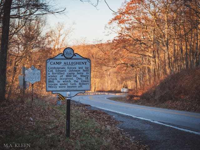
Camp Allegheny Battlefield
Old Pike RoadThe Battle of Camp Allegheny, also known as the Battle of Allegheny Mountain, took place on December 13, 1861, in Pocahontas County, Virginia (now West Virginia), about 3 miles from the mountainous border of Highland County, Virginia, as part of the Operations in Western Virginia Campaign during the American Civil War.[1] The battle was a small brigade-level conflict, and while the Confederates technically won with a Union withdrawal, it was considered militarily indecisive. However, it had critical implications for the future border of Virginia and West Virginia, ensuring Highland County remained in Confederate hands and would not be involved in the formation of the future state of West Virginia.
The Battle of Cheat Mountain, also known as the Battle of Cheat Summit Fort, took place from September 12 to 15, 1861, in Pocahontas County and Randolph County, Virginia (now West Virginia) as part of the Western Virginia Campaign during the American Civil War. It was the first battle of the Civil War in which Robert E. Lee led troops into combat.
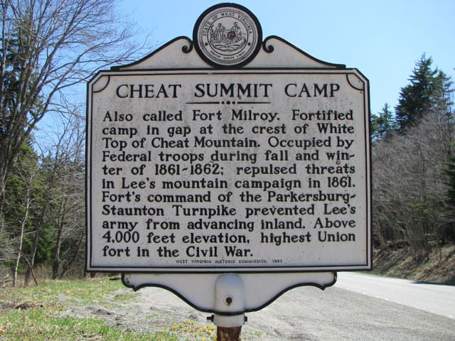
Cheat Summit Fort
U.S. 250The Battle of Cheat Mountain, also known as the Battle of Cheat Summit Fort, took place from September 12 to 15, 1861, in Pocahontas County and Randolph County, Virginia (now West Virginia) as part of the Western Virginia Campaign during the American Civil War. It was the first battle of the Civil War in which Robert E. Lee led troops into combat.
West Fork Trail (West Fork Greenbrier River WV) The West Fork Trail is a 27 mile long rail-trail that runs from Durbin WV to the Shavers Fork River . The main trail is 25.7 miles long with an additional 1.3 mile spur. It lies on the old railbed of the Coal & Iron Railroad which ran from Elkins to Durbin and first started service in 1903.
West Fork Trail
West Fork TrailWest Fork Trail (West Fork Greenbrier River WV) The West Fork Trail is a 27 mile long rail-trail that runs from Durbin WV to the Shavers Fork River . The main trail is 25.7 miles long with an additional 1.3 mile spur. It lies on the old railbed of the Coal & Iron Railroad which ran from Elkins to Durbin and first started service in 1903.
Located in the Allegheny Mountains of Tucker County, Blackwater Falls State Park is named for the amber waters of Blackwater Falls, a 57-foot cascade tinted by the tannic acid of fallen hemlock and red spruce needles. The falls, along with a few of the park’s other features like Elakala Falls, Lindy Point and Pendleton Point Overlook, are some of the state’s most photographed spots. Visitors can enjoy the scenic views year-round by taking the steps to the falls or using viewing platforms. The park has 20 miles of hiking trails and the longest sledding magic carpet on the East Coast.
112 (рекомендации местных жителей)
Государственный парк Blackwater Falls
1584 Blackwater Lodge RdLocated in the Allegheny Mountains of Tucker County, Blackwater Falls State Park is named for the amber waters of Blackwater Falls, a 57-foot cascade tinted by the tannic acid of fallen hemlock and red spruce needles. The falls, along with a few of the park’s other features like Elakala Falls, Lindy Point and Pendleton Point Overlook, are some of the state’s most photographed spots. Visitors can enjoy the scenic views year-round by taking the steps to the falls or using viewing platforms. The park has 20 miles of hiking trails and the longest sledding magic carpet on the East Coast.
Beverly Heritage Center combines four historic buildings in the center of Beverly, WV, to tell the story of the Battle of Rich Mountain and the First Campaign of the American Civil War, the pivotal role of the Staunton-Parkersburg Turnpike, and daily life in a small rural county seat through the 19th century.
Beverly Heritage Center
4 Court StBeverly Heritage Center combines four historic buildings in the center of Beverly, WV, to tell the story of the Battle of Rich Mountain and the First Campaign of the American Civil War, the pivotal role of the Staunton-Parkersburg Turnpike, and daily life in a small rural county seat through the 19th century.
The Camp Bartow Historic District — centered on the historic inn called "Traveller's Repose" and the site of the Battle of Greenbrier River — is a national historic district located at Bartow, Pocahontas County, West Virginia, United States. It is situated at the foot of Burner Mountain, at a bend in the East Fork Greenbrier River, where U.S. Route 28 intersects U.S. Route 250. The District encompasses ten contributing buildings and nine contributing sites. The house known as "Traveller's Repose" was built in 1869, and is a two-story, side gabled residence. It was expanded in 1912, and in 1928. The property also includes a simple two-story, side gabled residence built in 1898, with a rear 1+1⁄2-story addition. Contributing outbuildings associated with the Repose include a barn (1925), well house (c. 1930), woodshed (c. 1930), cellar house (c. 1870 / 1912), corn crib (c. 1940), and storage building (c. 1920). Located nearby and also contributing are an unpainted barn (c. 1910) and garage (c. 1940). The property also includes the Yeager Cemetery.
"Traveller's Repose" circa 2009
Sites associated with the American Civil War battle of October 3, 1861, known as the Battle of Greenbrier River, include four major fortifications, consisting of a series of trenches surrounding artillery emplacements. There are two additional artillery emplacements, camp / tent sites associated with Camp Bartow, and an unmarked Confederate Army cemetery containing 82 graves. Also included in the district is a section of the Staunton and Parkersburg Turnpike, constructed between 1838 and 1846
Camp Bartow Historic Site
Old Pike RoadThe Camp Bartow Historic District — centered on the historic inn called "Traveller's Repose" and the site of the Battle of Greenbrier River — is a national historic district located at Bartow, Pocahontas County, West Virginia, United States. It is situated at the foot of Burner Mountain, at a bend in the East Fork Greenbrier River, where U.S. Route 28 intersects U.S. Route 250. The District encompasses ten contributing buildings and nine contributing sites. The house known as "Traveller's Repose" was built in 1869, and is a two-story, side gabled residence. It was expanded in 1912, and in 1928. The property also includes a simple two-story, side gabled residence built in 1898, with a rear 1+1⁄2-story addition. Contributing outbuildings associated with the Repose include a barn (1925), well house (c. 1930), woodshed (c. 1930), cellar house (c. 1870 / 1912), corn crib (c. 1940), and storage building (c. 1920). Located nearby and also contributing are an unpainted barn (c. 1910) and garage (c. 1940). The property also includes the Yeager Cemetery.
"Traveller's Repose" circa 2009
Sites associated with the American Civil War battle of October 3, 1861, known as the Battle of Greenbrier River, include four major fortifications, consisting of a series of trenches surrounding artillery emplacements. There are two additional artillery emplacements, camp / tent sites associated with Camp Bartow, and an unmarked Confederate Army cemetery containing 82 graves. Also included in the district is a section of the Staunton and Parkersburg Turnpike, constructed between 1838 and 1846
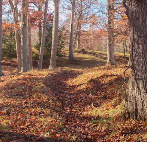
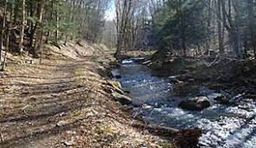
The Upper Shavers Fork Preserve is located along the banks of the Shavers Fork of the Cheat River at the center of the 40-mile long high elevation watershed that is the heart of West Virginia’s red spruce forests. These red spruce forests are not only spectacularly beautiful, with their green canopy and lush understories of rhododendron, mountain laurels, ferns, and mosses, but support one of the most biologically significant areas in West Virginia and the Central Appalachian Ecoregion. The high elevation of the landscape creates an environment that catches a good deal of moisture and sustains cool temperatures, allowing species generally associated with northern boreal forests to co-exist with more southern species. Well known boreal species such as the northern goshawk exist here with West Virginia endemics such as the West Virginia northern flying squirrel and the Cheat Mountain salamander. The high elevation of the river also creates ice floes which supports a scour zone along the river banks, a haven for rare plants such as Barbara’s buttons, sticky false asphodel, and fly poison.
The Cheat Mountain Conservation Area is one of the most significant areas of biodiversity concentration in West Virginia and the Central Appalachian Ecoregion. The Nature Conservancy has been actively involved with the US Forest Service to protect large areas of the landscape. Since 2000 the Nature Conservancy has worked to buy and transfer over 57,300 acres of mineral rights to the Monongahela National Forest to ensure that the area would be protected from mining. The Conservancy also worked to secure almost 1000 acres of surface ownership along the Shaver Fork River and in the area surrounding the Upper Shavers Preserve through the purchase of former CSX and Elk River Land Company properties. These properties have also been transferred on to the Monongahela National Forest. Through these efforts the Conservancy has helped create a 25-mile long area of the Watershed which is almost 100% public lands.
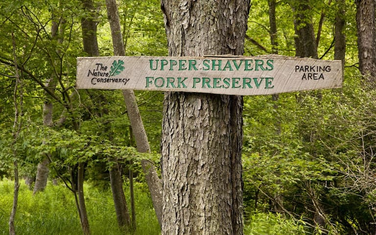
Shavers Fork
The Upper Shavers Fork Preserve is located along the banks of the Shavers Fork of the Cheat River at the center of the 40-mile long high elevation watershed that is the heart of West Virginia’s red spruce forests. These red spruce forests are not only spectacularly beautiful, with their green canopy and lush understories of rhododendron, mountain laurels, ferns, and mosses, but support one of the most biologically significant areas in West Virginia and the Central Appalachian Ecoregion. The high elevation of the landscape creates an environment that catches a good deal of moisture and sustains cool temperatures, allowing species generally associated with northern boreal forests to co-exist with more southern species. Well known boreal species such as the northern goshawk exist here with West Virginia endemics such as the West Virginia northern flying squirrel and the Cheat Mountain salamander. The high elevation of the river also creates ice floes which supports a scour zone along the river banks, a haven for rare plants such as Barbara’s buttons, sticky false asphodel, and fly poison.
The Cheat Mountain Conservation Area is one of the most significant areas of biodiversity concentration in West Virginia and the Central Appalachian Ecoregion. The Nature Conservancy has been actively involved with the US Forest Service to protect large areas of the landscape. Since 2000 the Nature Conservancy has worked to buy and transfer over 57,300 acres of mineral rights to the Monongahela National Forest to ensure that the area would be protected from mining. The Conservancy also worked to secure almost 1000 acres of surface ownership along the Shaver Fork River and in the area surrounding the Upper Shavers Preserve through the purchase of former CSX and Elk River Land Company properties. These properties have also been transferred on to the Monongahela National Forest. Through these efforts the Conservancy has helped create a 25-mile long area of the Watershed which is almost 100% public lands.
Widney Park Rail-Trail by West Virginia Rails to Trails is an 8 mile long hiking and mountain biking trail located in the quiet West Virginia community of Durbin. The old railroad town has a charming Main Street with welcoming shops and restaurants and the rail-trail is located just a block south of it.
Widney Park Drive
Widney Park DriveWidney Park Rail-Trail by West Virginia Rails to Trails is an 8 mile long hiking and mountain biking trail located in the quiet West Virginia community of Durbin. The old railroad town has a charming Main Street with welcoming shops and restaurants and the rail-trail is located just a block south of it.
Embrace winter and Ski the Valley in Tucker County this season. With an average snowfall of 150 inches per year and an elevation of over 4,000 feet, we have all the natural ingredients that make our high-mountain paradise ideal for skiing, snowboarding, tubing, sledding and other seasonal activities. Check out our three premier ski resorts for the perfect winter playgrounds.
Along with our outdoor recreation and stunning scenic beauty, you’ll uncover charming small towns that are full of flavor. Explore the diverse dining and art scenes before unwinding.
41 (рекомендации местных жителей)
Горнолыжный курорт Канаан Вэлли
Park Road 826Embrace winter and Ski the Valley in Tucker County this season. With an average snowfall of 150 inches per year and an elevation of over 4,000 feet, we have all the natural ingredients that make our high-mountain paradise ideal for skiing, snowboarding, tubing, sledding and other seasonal activities. Check out our three premier ski resorts for the perfect winter playgrounds.
Along with our outdoor recreation and stunning scenic beauty, you’ll uncover charming small towns that are full of flavor. Explore the diverse dining and art scenes before unwinding.
Seneca State Forest is a state forest located in Pocahontas County, West Virginia. Created in 1924, it is oldest state forest in West Virginia. It is also West Virginia's second-largest state forest at 11,684 acres.
Seneca State Forest
10135 Browns Creek RoadSeneca State Forest is a state forest located in Pocahontas County, West Virginia. Created in 1924, it is oldest state forest in West Virginia. It is also West Virginia's second-largest state forest at 11,684 acres.
The Dolly Sods Wilderness — originally simply Dolly Sods — is a U.S. Wilderness Area in the Allegheny Mountains of eastern West Virginia, US, and is part of the Monongahela National Forest (MNF) of the U.S. Forest Service (USFS).
Dolly Sods is a rocky, high-altitude plateau with sweeping vistas and lifeforms normally found much farther north in Canada. To the north, the distinctive landscape of "the Sods" is characterized by stunted ("flagged") trees, wind-carved boulders, heath barrens, grassy meadows created in the last century by logging and fires, and sphagnum bogs that are much older. To the south, a dense cove forest occupies the branched canyon excavated by the North Fork of Red Creek.
33 (рекомендации местных жителей)
Dolly Sods Wilderness
The Dolly Sods Wilderness — originally simply Dolly Sods — is a U.S. Wilderness Area in the Allegheny Mountains of eastern West Virginia, US, and is part of the Monongahela National Forest (MNF) of the U.S. Forest Service (USFS).
Dolly Sods is a rocky, high-altitude plateau with sweeping vistas and lifeforms normally found much farther north in Canada. To the north, the distinctive landscape of "the Sods" is characterized by stunted ("flagged") trees, wind-carved boulders, heath barrens, grassy meadows created in the last century by logging and fires, and sphagnum bogs that are much older. To the south, a dense cove forest occupies the branched canyon excavated by the North Fork of Red Creek.
Cranberry Glades — also known simply as The Glades — are a cluster of five small, boreal-type bogs in southwestern Pocahontas County, West Virginia, United States. This area, high in the Allegheny Mountains at about 3,400 feet (1,000 m), is protected as the Cranberry Glades Botanical Area, part of the Monongahela National Forest. This site is the headwaters of the Cranberry River, a popular trout stream, and is adjacent to the nearly 50,000-acre (200 km2) Cranberry Wilderness.
The Glades are a 750-acre (3.0 km2)[1] grouping of peat bogs resembling some Canadian bogs. The gladed land is highly acidic and supports plants commonly found at higher latitudes, including cranberries, sphagnum moss, skunk cabbage, and two carnivorous plants (purple pitcher plant, sundew). The Glades serve as the southernmost home of many of the plant species found there.
The Glades have been the subject of much scientific study, especially during the 1930s, 1940s and 1950s. Professor Maurice Brooks conducted studies in 1930, 1934, and 1945. The work of Strausbaugh (1934), Darlington (1943), and Core (1955) followed.
24 (рекомендации местных жителей)
Cranberry Glades Botanical Area
Cranberry Glades — also known simply as The Glades — are a cluster of five small, boreal-type bogs in southwestern Pocahontas County, West Virginia, United States. This area, high in the Allegheny Mountains at about 3,400 feet (1,000 m), is protected as the Cranberry Glades Botanical Area, part of the Monongahela National Forest. This site is the headwaters of the Cranberry River, a popular trout stream, and is adjacent to the nearly 50,000-acre (200 km2) Cranberry Wilderness.
The Glades are a 750-acre (3.0 km2)[1] grouping of peat bogs resembling some Canadian bogs. The gladed land is highly acidic and supports plants commonly found at higher latitudes, including cranberries, sphagnum moss, skunk cabbage, and two carnivorous plants (purple pitcher plant, sundew). The Glades serve as the southernmost home of many of the plant species found there.
The Glades have been the subject of much scientific study, especially during the 1930s, 1940s and 1950s. Professor Maurice Brooks conducted studies in 1930, 1934, and 1945. The work of Strausbaugh (1934), Darlington (1943), and Core (1955) followed.
The Greenbrier River Trail is a 78-mile former railroad now used for hiking, biking and horseback riding. It is the longest trail of its kind in West Virginia. The trail provides many breathtaking views as it passes through several small towns, crosses 35 bridges, goes through two tunnels and cuts through some of West Virginia’s most remote areas. The Greenbrier River Trail is one of 50 Millennium Legacy Trails in the United States, and was rated one of the top 10 hiking trails in the country by Backpacker Magazine. Part of the Greenbrier River Trail lies within a National Radio Quiet Zone so cell phones do not work.
9 (рекомендации местных жителей)
Greenbrier River Trail Trailhead
Greenbrier River TrailThe Greenbrier River Trail is a 78-mile former railroad now used for hiking, biking and horseback riding. It is the longest trail of its kind in West Virginia. The trail provides many breathtaking views as it passes through several small towns, crosses 35 bridges, goes through two tunnels and cuts through some of West Virginia’s most remote areas. The Greenbrier River Trail is one of 50 Millennium Legacy Trails in the United States, and was rated one of the top 10 hiking trails in the country by Backpacker Magazine. Part of the Greenbrier River Trail lies within a National Radio Quiet Zone so cell phones do not work.
Trailhead is just across the bridge upriver. Only 5 minutes walk from River House.
The Allegheny Trail travels from Virginia to Pennsylvania. This 5 miles of the Allegheny Trail is the only section of the trail on the Monongahela National Forest. The section often called the Davis Trail runs from Blackwater Falls State Park to the Canaan Loop Road. The section from the Canaan Loop Road to Canaan Valley State Park is often called the Canaan-Blackwater Cross-Country Ski Trail. Approximately 1.2 miles of this 5 mile section follows along the Canaan Loop Road. Approximate hiking time for this section is 2 hours.
The Allegheny Trail continues south of Canaan Valley State Park along the Glady Fork River and eventually ends up in Virginia. It continues north of Blackwater Falls State Park and goes to Pennsylvania. A 6-person Adirondack Shelter is located along this section of trail just north of the trails junction with the Plantation Trail.
Allegheny Trailhead (Simmons Rd)
Simmons RoadTrailhead is just across the bridge upriver. Only 5 minutes walk from River House.
The Allegheny Trail travels from Virginia to Pennsylvania. This 5 miles of the Allegheny Trail is the only section of the trail on the Monongahela National Forest. The section often called the Davis Trail runs from Blackwater Falls State Park to the Canaan Loop Road. The section from the Canaan Loop Road to Canaan Valley State Park is often called the Canaan-Blackwater Cross-Country Ski Trail. Approximately 1.2 miles of this 5 mile section follows along the Canaan Loop Road. Approximate hiking time for this section is 2 hours.
The Allegheny Trail continues south of Canaan Valley State Park along the Glady Fork River and eventually ends up in Virginia. It continues north of Blackwater Falls State Park and goes to Pennsylvania. A 6-person Adirondack Shelter is located along this section of trail just north of the trails junction with the Plantation Trail.
New Tygart Flyer-Elkins, WV
This wilderness excursion features mountain grades, an “S” curve tunnel, a high bridge and miles of unspoiled mountain views. Vintage diesel-powered locomotives climb along the cascading Shavers Fork of the Cheat River to the High Falls of Cheat. Enjoy the view relaxing aboard our comfortable climate controlled passenger coaches.
This vintage diesel-powered passenger train has gained a reputation as one of the most relaxing mountain wilderness excursions in our Mountain Rail Adventure portfolio. The 4-hour, 46 mile round trip departs at 11 a.m. from the restored Elkins Depot on Railroad Avenue.
On the trip to the Falls, enjoy a cold cut lunch, which is included in the ticket price. The trip culminates at the High Falls of Cheat, an 18′ high, 150′ wide waterfall located in one of the most remote and pristine settings in the region. If you’re looking for comfort and spectacular views on a vintage train this is the ride for you!
Looking for extra leg room? Adult beverages, or your own private train host? Upgrade to our Parlor Car service for these special perks and more!
12 (рекомендации местных жителей)
MountainRail
315 Railroad AveNew Tygart Flyer-Elkins, WV
This wilderness excursion features mountain grades, an “S” curve tunnel, a high bridge and miles of unspoiled mountain views. Vintage diesel-powered locomotives climb along the cascading Shavers Fork of the Cheat River to the High Falls of Cheat. Enjoy the view relaxing aboard our comfortable climate controlled passenger coaches.
This vintage diesel-powered passenger train has gained a reputation as one of the most relaxing mountain wilderness excursions in our Mountain Rail Adventure portfolio. The 4-hour, 46 mile round trip departs at 11 a.m. from the restored Elkins Depot on Railroad Avenue.
On the trip to the Falls, enjoy a cold cut lunch, which is included in the ticket price. The trip culminates at the High Falls of Cheat, an 18′ high, 150′ wide waterfall located in one of the most remote and pristine settings in the region. If you’re looking for comfort and spectacular views on a vintage train this is the ride for you!
Looking for extra leg room? Adult beverages, or your own private train host? Upgrade to our Parlor Car service for these special perks and more!
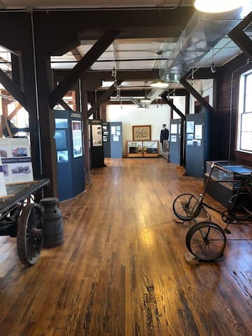
The West Virginia Railroad Museum is located in the historic Darden Mill in Elkins, West Virginia—a city that was built by the railroads. The Darden Mill was built in 1902, on land purchased from the West Virginia Central and Pittsburg Railway Company. It was a grain mill between 1902 and 1943, run first by the Elkins Milling Company then the Darden Company. In the second half of the 20th century, it was a farm supply store, used furniture store, and a junk shop.
The building is currently owned by C-HOPE (Citizens for Historical Opportunity, Preservation, and Education in Randolph County), who purchased and restored the building. Located just blocks from the Elkins Depot and alongside the train tracks, the Darden Mill is the ideal location for the West Virginia Railroad Museum. The museum, located above the Appalachian Forest Discover Center on the second floor, has limited parking, but free on-street parking is widely available in the downtown area.
The museum is open Thursday – Sunday from 9:30 am to 5:00 pm. The WVRRM presents a new temporary exhibit each year from April-October. This large exhibit is accented by pieces from our permanent collection. There is a $5 admission fee to visit the museum. Children 12 and under, and museum members, receive free admission. Contact us to arrange a group visit.
West Virginia Railroad Museum
2 Railroad AveThe West Virginia Railroad Museum is located in the historic Darden Mill in Elkins, West Virginia—a city that was built by the railroads. The Darden Mill was built in 1902, on land purchased from the West Virginia Central and Pittsburg Railway Company. It was a grain mill between 1902 and 1943, run first by the Elkins Milling Company then the Darden Company. In the second half of the 20th century, it was a farm supply store, used furniture store, and a junk shop.
The building is currently owned by C-HOPE (Citizens for Historical Opportunity, Preservation, and Education in Randolph County), who purchased and restored the building. Located just blocks from the Elkins Depot and alongside the train tracks, the Darden Mill is the ideal location for the West Virginia Railroad Museum. The museum, located above the Appalachian Forest Discover Center on the second floor, has limited parking, but free on-street parking is widely available in the downtown area.
The museum is open Thursday – Sunday from 9:30 am to 5:00 pm. The WVRRM presents a new temporary exhibit each year from April-October. This large exhibit is accented by pieces from our permanent collection. There is a $5 admission fee to visit the museum. Children 12 and under, and museum members, receive free admission. Contact us to arrange a group visit.
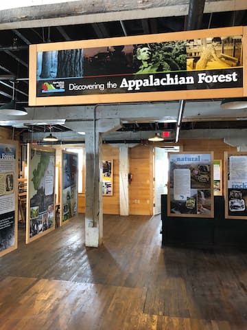
The Appalachian Forest Discovery Center museum is located on the first floor of the Darden Mill, a National Historic Landmark, in downtown Elkins. The Darden Mill, built in 1902, was a historic grist mill known as the Elkins Milling Company. The West Virginia Railroad Museum occupies the second floor of the Darden Mill.
The Appalachian Forest Discovery Center opened its doors in 2015, but the ideas behind it started several years earlier with the creation of the Appalachian Forest Heritage Area (AFHA), designated as a National Heritage Area in 2019. AFHA is a non-profit organization that aims to integrate central Appalachian forest history, culture, natural history, products, and forestry management into a heritage tourism initiative to promote rural community development.
Since its opening, the Discovery Center has endeavored to create engaging exhibits that explore AFHA’s four focuses: Forestry, Nature, Culture, and History. The main exhibit touches on all four of the topics, while a yearly temporary exhibit rotates between the themes in order to provide a deeper insight into one of the topics. Open April through October.
Appalachian Forest Discovery Center
101 Railroad AveThe Appalachian Forest Discovery Center museum is located on the first floor of the Darden Mill, a National Historic Landmark, in downtown Elkins. The Darden Mill, built in 1902, was a historic grist mill known as the Elkins Milling Company. The West Virginia Railroad Museum occupies the second floor of the Darden Mill.
The Appalachian Forest Discovery Center opened its doors in 2015, but the ideas behind it started several years earlier with the creation of the Appalachian Forest Heritage Area (AFHA), designated as a National Heritage Area in 2019. AFHA is a non-profit organization that aims to integrate central Appalachian forest history, culture, natural history, products, and forestry management into a heritage tourism initiative to promote rural community development.
Since its opening, the Discovery Center has endeavored to create engaging exhibits that explore AFHA’s four focuses: Forestry, Nature, Culture, and History. The main exhibit touches on all four of the topics, while a yearly temporary exhibit rotates between the themes in order to provide a deeper insight into one of the topics. Open April through October.
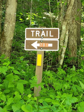
Different from the Allegheny Trail 701 that runs from Virginia to Pennsylvania and passes through Durbin.
Try this 14.6-mile out-and-back trail near Riverton, West Virginia. Generally considered a challenging route, it takes an average of 8 h 13 min to complete. This is a popular trail for birding and hiking, but you can still enjoy some solitude during quieter times of day. The best times to visit this trail are March through October. Dogs are welcome but must be on a leash.
Allegheny Mountain Trail
Allegheny Mountain TrailDifferent from the Allegheny Trail 701 that runs from Virginia to Pennsylvania and passes through Durbin.
Try this 14.6-mile out-and-back trail near Riverton, West Virginia. Generally considered a challenging route, it takes an average of 8 h 13 min to complete. This is a popular trail for birding and hiking, but you can still enjoy some solitude during quieter times of day. The best times to visit this trail are March through October. Dogs are welcome but must be on a leash.
Food scene
Station 2 offers home-style favorites, as well as American restaurant classics. Adorned with firefighter gear and memorabilia, in tribute to the local fire department and dedicated service men and women everywhere, Station 2 offers comfortable casual dining, with views of the Durbin Rocket scenic excursion train just across the street. Stop by Station 2 for a slice of homemade pie and a taste of Appalachian style Americana. Oh... and don't forget to ask about our delicious daily meal and dessert specials!
A great breakfast spot.
Just a 3 minutes' walk from River House.

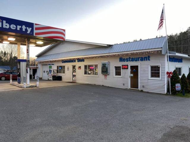
Station 2 Restaurant & Motel
Main StreetStation 2 offers home-style favorites, as well as American restaurant classics. Adorned with firefighter gear and memorabilia, in tribute to the local fire department and dedicated service men and women everywhere, Station 2 offers comfortable casual dining, with views of the Durbin Rocket scenic excursion train just across the street. Stop by Station 2 for a slice of homemade pie and a taste of Appalachian style Americana. Oh... and don't forget to ask about our delicious daily meal and dessert specials!
A great breakfast spot.
Just a 3 minutes' walk from River House.
Ice Cream Counter at The Rail and Trail Store. A minutes walk. Shopping with a mountain rail and trail theme.
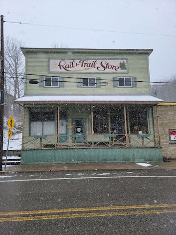
Durbin Rail & Trail Store
Main StreetIce Cream Counter at The Rail and Trail Store. A minutes walk. Shopping with a mountain rail and trail theme.
Quaint local cafe featuring coffee, frappe, Capuchino, mocha, chai and latte's as well as an eclectic breakfast and lunch menu. Daily Specials.
A 1-minute walk from River House. Wednesday through Saturday 8:00 to 6:00 and Sunday 8:00 to 4:00.

SIMPLY SWEET CAFE
4781 U.S. 250Quaint local cafe featuring coffee, frappe, Capuchino, mocha, chai and latte's as well as an eclectic breakfast and lunch menu. Daily Specials.
A 1-minute walk from River House. Wednesday through Saturday 8:00 to 6:00 and Sunday 8:00 to 4:00.
Hunt Brothers Pizza located in the PAR MAR Store in Bartow, WV. Groceries, gas, pizza, wings and subs.
6751 Staunton Parkersburg Turnpike, Bartow, WV 24920
304-561-4191
3.2 Miles from River House

Par Mar Stores
6784 Staunton Parkersburg TurnpikeHunt Brothers Pizza located in the PAR MAR Store in Bartow, WV. Groceries, gas, pizza, wings and subs.
6751 Staunton Parkersburg Turnpike, Bartow, WV 24920
304-561-4191
3.2 Miles from River House
The Bears Den would like to provide everyone with a home cooked homemade meal at a reasonable price. We are friendly and our staff is very polite and top of the line. We hope that you stop by and dine in with us.
(681) 206-7973
10811 Potomac Higland Trail
Arbovale, WV 24915
11 Miles from River House.
The Bears Den
10811 Potomac Highlands TrailThe Bears Den would like to provide everyone with a home cooked homemade meal at a reasonable price. We are friendly and our staff is very polite and top of the line. We hope that you stop by and dine in with us.
(681) 206-7973
10811 Potomac Higland Trail
Arbovale, WV 24915
11 Miles from River House.
Located in the Village at Snowshoe Mountain Resort-Offering a diverse beer selection, a full bar, made from scratch soups, salads and sandwiches- including a variety of vegetarian options- at a great price!
10 Snowshoe Drive
Snowshoe, West Virginia
(304) 572-1020
OldSpruceTavern@gmail.com
30 Miles from River House
13 (рекомендации местных жителей)
Old Spruce Brewing
52 Silver Creek RdLocated in the Village at Snowshoe Mountain Resort-Offering a diverse beer selection, a full bar, made from scratch soups, salads and sandwiches- including a variety of vegetarian options- at a great price!
10 Snowshoe Drive
Snowshoe, West Virginia
(304) 572-1020
OldSpruceTavern@gmail.com
30 Miles from River House
Local cuisine, American, Bar, Vegetarian Friendly, Vegan Options. At Foxfire you'll find amazing sunset views. sandwiches, dinner entrees, and "Honest to Goodness Southern Barbecue."
1 Rimfire Lodge
Snowshoe, WV 26209
1 304-572-5555
30 miles from River House
23 (рекомендации местных жителей)
Foxfire Grille
1 Rimfire LodgeLocal cuisine, American, Bar, Vegetarian Friendly, Vegan Options. At Foxfire you'll find amazing sunset views. sandwiches, dinner entrees, and "Honest to Goodness Southern Barbecue."
1 Rimfire Lodge
Snowshoe, WV 26209
1 304-572-5555
30 miles from River House
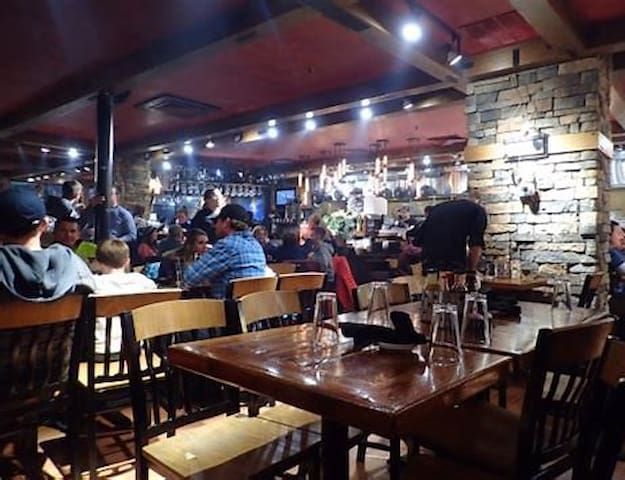
Located in the heart of Snowshoe Mountain Village, Cheat Mountain Pizza serves up specialty pizzas, sandwiches, salads, pasta, cocktails, and a large selection of craft beer. Enjoy their entertaining atmosphere and spacious inside and outside seating. View Menu View Hours
Phone: 304-572-5949
Hours
Mon 9:00am-4:30pm
Tue 9:00am-4:30pm
Wed 9:00am-4:30pm
Thu 9:00am-4:30pm
Fri 9:00am-4:30pm
Sat 9:00am-4:30pm
Sun 9:00am-4:30pm
30 Miles from River House
13 (рекомендации местных жителей)
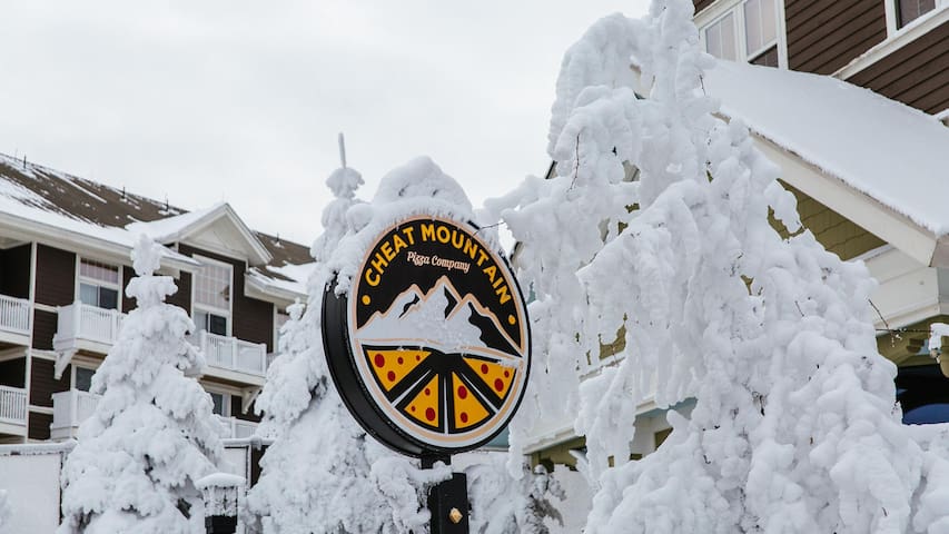
Cheat Mountain Pizza
10 Snowshoe DrLocated in the heart of Snowshoe Mountain Village, Cheat Mountain Pizza serves up specialty pizzas, sandwiches, salads, pasta, cocktails, and a large selection of craft beer. Enjoy their entertaining atmosphere and spacious inside and outside seating. View Menu View Hours
Phone: 304-572-5949
Hours
Mon 9:00am-4:30pm
Tue 9:00am-4:30pm
Wed 9:00am-4:30pm
Thu 9:00am-4:30pm
Fri 9:00am-4:30pm
Sat 9:00am-4:30pm
Sun 9:00am-4:30pm
30 Miles from River House
Upscale steakhouse and bar located in Soaring Eagle, featuring amazing steaks, seafood, and extensive wine selection. The best place on the mountain for a fine dining experience.
The premier dining spot on the Mountain. Full service, resort casual dress, formal dress always welcome!
Located in the Soaring Eagle Lodge - South Mountain. Shuttles and parking available.
US Prime Beef, Great Seafood selections, Delicious wine list, full bar, apps and more!
Dinner only Thursday thru Sunday
Dress is resort casual. Gentleman please remove your hats.
No Ski Boots, Snowboard Boots, Ski or Board pants, Hoodies.
Reservation only via phone 304-572-5821 or Opentable.com, if open table is booked calling us helps.
Thank you!

10 Prime Steakhouse and Bar
1 Soaring Eagle LnUpscale steakhouse and bar located in Soaring Eagle, featuring amazing steaks, seafood, and extensive wine selection. The best place on the mountain for a fine dining experience.
The premier dining spot on the Mountain. Full service, resort casual dress, formal dress always welcome!
Located in the Soaring Eagle Lodge - South Mountain. Shuttles and parking available.
US Prime Beef, Great Seafood selections, Delicious wine list, full bar, apps and more!
Dinner only Thursday thru Sunday
Dress is resort casual. Gentleman please remove your hats.
No Ski Boots, Snowboard Boots, Ski or Board pants, Hoodies.
Reservation only via phone 304-572-5821 or Opentable.com, if open table is booked calling us helps.
Thank you!
Welcome!
We offer farm-to-table modern American cuisine with regional Appalachian flare. All our meats are sourced regionally from Appalachian farms, and when the season permits, our produce is also sourced from regional farms.
Come join us and enjoy the freshest and tastiest food on the mountain!
- Kristin and David Billings, Owners
Located at The Corduroy Inn, behind The Pizza Slice
Summer Hours
Fri/Sat/ 5 PM to 9 PM
Sundays open Jul/Aug/Holidays
Thurs for UCI and GNCC
Appalachia Kitchen
5811 Snowshoe Dr
Snowshoe, WV 26209
(304) 572-2030
info@corduroyinn.com
16 (рекомендации местных жителей)
Appalachia Kitchen
5811 Snowshoe DrWelcome!
We offer farm-to-table modern American cuisine with regional Appalachian flare. All our meats are sourced regionally from Appalachian farms, and when the season permits, our produce is also sourced from regional farms.
Come join us and enjoy the freshest and tastiest food on the mountain!
- Kristin and David Billings, Owners
Located at The Corduroy Inn, behind The Pizza Slice
Summer Hours
Fri/Sat/ 5 PM to 9 PM
Sundays open Jul/Aug/Holidays
Thurs for UCI and GNCC
Appalachia Kitchen
5811 Snowshoe Dr
Snowshoe, WV 26209
(304) 572-2030
info@corduroyinn.com
The art and science of making the best waffles in the world. Vermont Belgium Waffles.
3 Silver Creek Drive
Snowshoe, WV 26209
30 Miles from River House

Waffle Cabin
10 Snowshoe DriveThe art and science of making the best waffles in the world. Vermont Belgium Waffles.
3 Silver Creek Drive
Snowshoe, WV 26209
30 Miles from River House
THE BEST SOUTHWEST FOOD AT SNOWSHOE
Add a little spice to your mountain getaway with Sunset Cantina. They're serving up traditional Southwest dishes with a twist. Try the street tacos, loaded nachos, or fajitas. Top it off with a delicious house-made margarita and signature Snowshoe sunset, and that's the perfect way to end your day on the mountain.
6 (рекомендации местных жителей)
Sunset Cantina
THE BEST SOUTHWEST FOOD AT SNOWSHOE
Add a little spice to your mountain getaway with Sunset Cantina. They're serving up traditional Southwest dishes with a twist. Try the street tacos, loaded nachos, or fajitas. Top it off with a delicious house-made margarita and signature Snowshoe sunset, and that's the perfect way to end your day on the mountain.
The Pizza Slice
Come Enjoy True Artisan Pizza at Snowshoe Resort
Welcome to The Pizza Slice, serving wood-fired pizza and gelato!
All our pizzas are made-to-order with the freshest ingredients. Our dough is made from scratch in-house daily, and our tomato sauce is also made in-house from imported San Marzano plum tomatoes. Come savor the best pizza around!
We are conveniently located across the street from the top of Western Express chairlift, at the Corduroy Inn. You can enjoy our pizza at Tuque's Bar next door for dine-in service, and we also offer convenient curbside takeout!
www.snowshoepizza.com
5811 Snowshoe Dr, Snowshoe, WV 26209
(304) 572-0120
30 Miles from River House
8 (рекомендации местных жителей)
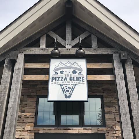
The Pizza Slice - Wood-Fired Pizza and Gelato
5811 Snowshoe DrThe Pizza Slice
Come Enjoy True Artisan Pizza at Snowshoe Resort
Welcome to The Pizza Slice, serving wood-fired pizza and gelato!
All our pizzas are made-to-order with the freshest ingredients. Our dough is made from scratch in-house daily, and our tomato sauce is also made in-house from imported San Marzano plum tomatoes. Come savor the best pizza around!
We are conveniently located across the street from the top of Western Express chairlift, at the Corduroy Inn. You can enjoy our pizza at Tuque's Bar next door for dine-in service, and we also offer convenient curbside takeout!
www.snowshoepizza.com
5811 Snowshoe Dr, Snowshoe, WV 26209
(304) 572-0120
30 Miles from River House
BEST PLACE TO GRAB A BEER AT SNOWSHOE
Classic Americana cuisine finds interesting twists and the flare of modern recipes. The warm atmosphere and reimagined menu pairs perfectly with any one of the many WV craft beers that are always in stock.
30 Miles from River House.
12 (рекомендации местных жителей)
The Junction
Snowshoe DriveBEST PLACE TO GRAB A BEER AT SNOWSHOE
Classic Americana cuisine finds interesting twists and the flare of modern recipes. The warm atmosphere and reimagined menu pairs perfectly with any one of the many WV craft beers that are always in stock.
30 Miles from River House.
Gift Shop and Bakery. Come visit The Mtn. Shop for a fresh brewed cup of coffee or tea and fresh baked goods while you shop for that unique gift. Located right next to the GreenBank post office at 8075 Wesley Chapel Rd. Green Bank Wv. 24944 Gifts. Pocket knives, clothing candles, mugs, decor, coffee, tea, the Occasional antique 304-413-6335
13 miles from River House.
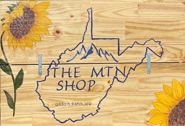
The Mtn Shop
Wesley Chapel RoadGift Shop and Bakery. Come visit The Mtn. Shop for a fresh brewed cup of coffee or tea and fresh baked goods while you shop for that unique gift. Located right next to the GreenBank post office at 8075 Wesley Chapel Rd. Green Bank Wv. 24944 Gifts. Pocket knives, clothing candles, mugs, decor, coffee, tea, the Occasional antique 304-413-6335
13 miles from River House.
Neighborhoods
Durbin in an historic rail town situated in the northern part of Pocahontas County at the confluence of the East and West Forks of the Greenbrier River. It is thus the starting point of the Greenbrier River proper. The town of 293 people has restaurants, a visitors' center, library, park and shopping. It is the home of the Greenbrier Valley Railroads Durbin Station, home of the Durbin Rocket Historic Tourist Train.
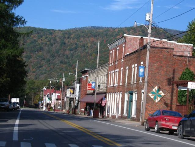
Durbin
Durbin in an historic rail town situated in the northern part of Pocahontas County at the confluence of the East and West Forks of the Greenbrier River. It is thus the starting point of the Greenbrier River proper. The town of 293 people has restaurants, a visitors' center, library, park and shopping. It is the home of the Greenbrier Valley Railroads Durbin Station, home of the Durbin Rocket Historic Tourist Train.
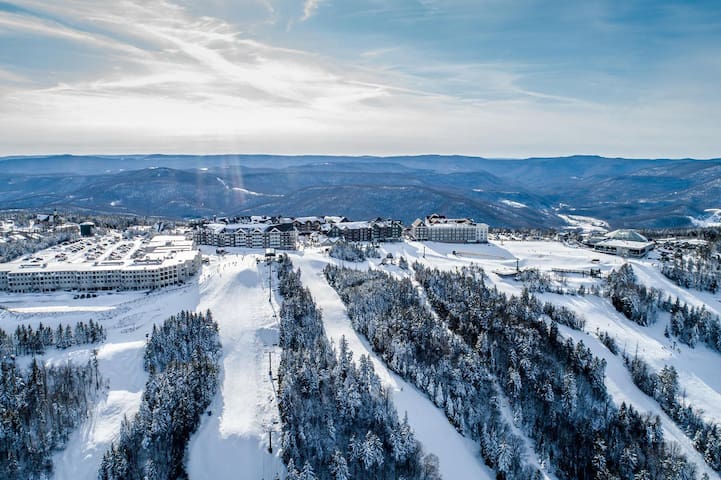
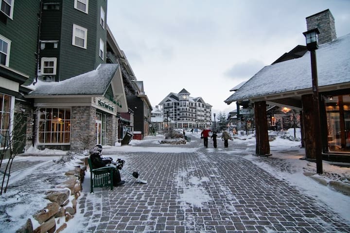
Snowshoe, West Virginia is an unincorporated community in Pocahontas County, West Virginia, United States, centering on the Snowshoe Mountain ski resort. It is situated in the Allegheny Mountains at a bowl-shaped convergence of two high mountain ridges — Cheat and Back Allegheny Mountains — at the head of the Shavers Fork of the Cheat River. Snowshoe is site of the second highest point in the state and the peak elevation for Cheat Mountain, at Thorny Flat, which reaches 4,848 feet (1,478 m) above sea level.
Snowshoe has several commercial areas, with the most prominent being The Village at Snowshoe, located at the summit of the mountain (rather than at its base). While the area is still best known for winter activities, today the resort has extensive mountain biking trails, a popular golf course, wedding and convention areas, a number of summer outdoor activities, and also hosts a Grand National Cross Country racing event. About 480,000 skiers visit the area each year, primarily from West Virginia and the larger cities of the Mid-Atlantic and Southeast.
Snowshoe Mountain's large property includes several developed resort areas, a conservation area, and expansive backcountry that covers 10,950 acres (44.31 km2) in total. Ski slopes make up 244 acres (0.99 km2) of the resort, which include the Snowshoe Basin, Western Territory, and Silver Creek areas.
48 (рекомендации местных жителей)
Snowshoe
Snowshoe, West Virginia is an unincorporated community in Pocahontas County, West Virginia, United States, centering on the Snowshoe Mountain ski resort. It is situated in the Allegheny Mountains at a bowl-shaped convergence of two high mountain ridges — Cheat and Back Allegheny Mountains — at the head of the Shavers Fork of the Cheat River. Snowshoe is site of the second highest point in the state and the peak elevation for Cheat Mountain, at Thorny Flat, which reaches 4,848 feet (1,478 m) above sea level.
Snowshoe has several commercial areas, with the most prominent being The Village at Snowshoe, located at the summit of the mountain (rather than at its base). While the area is still best known for winter activities, today the resort has extensive mountain biking trails, a popular golf course, wedding and convention areas, a number of summer outdoor activities, and also hosts a Grand National Cross Country racing event. About 480,000 skiers visit the area each year, primarily from West Virginia and the larger cities of the Mid-Atlantic and Southeast.
Snowshoe Mountain's large property includes several developed resort areas, a conservation area, and expansive backcountry that covers 10,950 acres (44.31 km2) in total. Ski slopes make up 244 acres (0.99 km2) of the resort, which include the Snowshoe Basin, Western Territory, and Silver Creek areas.